Severe Winter Weather Alert: Snow and Strong Winds to Hit Great Lakes and Northeast
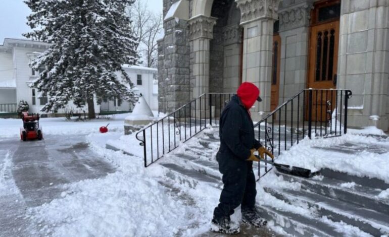
A fierce winter storm, which rapidly intensified into a bomb cyclone over the northern United States on Monday, has shifted its focus eastward. On Tuesday, the Great Lakes and Northeast are bracing for a barrage of heavy snow, powerful winds, and dangerously frigid temperatures, following a trail of disruption that left tens of thousands without power.
The storm’s first act brought chaos to the Plains and Great Lakes. Blizzard conditions, a treacherous mix of ice and rain, and violent winds created perilous travel and triggered widespread power outages. As of Tuesday morning, more than 127,000 customers remained in the dark nationwide, with Michigan accounting for over a third of those outages.
Now, the system’s final push is underway. The National Weather Service warns that as the storm moves into Canada, the Eastern U.S. will face a severe follow-up: sudden, intense bursts of heavy snow known as snow squalls, paired with gusty winds that will create whiteout conditions.
New York Governor Kathy Hochul urged residents in impacted areas, including Syracuse, to avoid all unnecessary travel. “Whiteout conditions were expected,” she cautioned.
A Storm of Dramatic Extremes
The cyclone’s impact has been both profound and visually startling. In Michigan’s Upper Peninsula, snowfall piled up to two feet in some areas. The storm’s fierce winds churned the Great Lakes into a frenzy, generating waves up to 20 feet on Lake Superior and forcing nearly every cargo ship to seek shelter.
On Lake Erie, the powerful westerly winds created a dramatic hydraulic effect. Water surged toward the eastern end near Buffalo, New York, while simultaneously pulling the lake away from the western shoreline in Michigan. The receding waters exposed normally submerged history, including old wooden pier pilings from the 1830s and even the wreckage of a car and a snowmobile.
“Where those are at would typically be probably 12 feet deep,” said Kevin Aldrich of Monroe, Michigan, who documented the scene. “We can usually drive our boat over them.”
Deep Chill and Lingering Dangers
Beyond the snow, a penetrating Arctic chill is the storm’s lasting signature. Wind chills plunged as low as -30°F (-34°C) in North Dakota and Minnesota. The cold is pushing deep into the South, with below-freezing temperatures expected as far south as the Florida Panhandle.
The aftermath of the initial blizzard continues to cause problems. In Iowa, high winds persisted after the snow stopped, blowing powder across roads and keeping a more than 200-mile stretch of Interstate 35 closed. State officials reported dozens of storm-related crashes, including one fatality.
While the Northeast bears the brunt of this latest wave, other parts of the country are not spared. Southern California is bracing for Santa Ana winds, which could topple trees in rain-saturated soil, and forecasters are eyeing potential New Year’s Day rain that could dampen the Rose Parade for the first time in nearly twenty years.
Residents across the affected regions are urged to exercise extreme caution, heed travel bans, and prepare for a severe and prolonged winter blast as this powerful storm system makes its exit.
Also Read:
North Korea Conducts New Long-Range Cruise Missile Test
Trump Says Ukraine and Russia Are Closer to Peace After Zelensky Talks


